


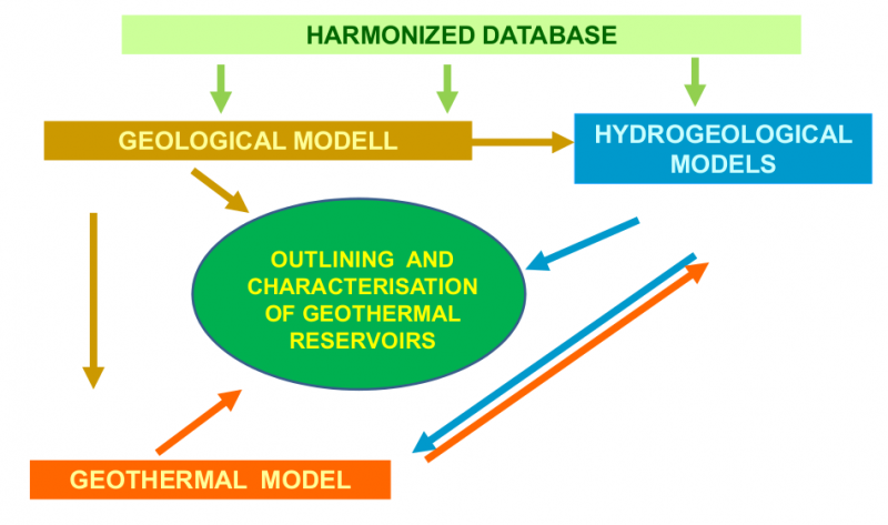
| Approach | Extent of the reservoir | Characterization |
| -geological volume |
geological-hydrogeological units; regional scale |
location, geometry, lithology, temperature |
-economical estimation; |
thermal energy can exploited economically |
resource cost estimation |
| -engineering | surroundings of wells | well test permeability, yield |
The aim of outlining and characterization of reservoirs in TRANSENERGY:
-to identify potential geological/hydrogeological units containing thermal water
-to provide information about utilization possibilities (especially for energy purposes) for stakeholders and decision makers
(Not suitable for geothermal well design)
Thermal water: higher than 20°C but reservoir outlining and characterization restricted higher than 50°C
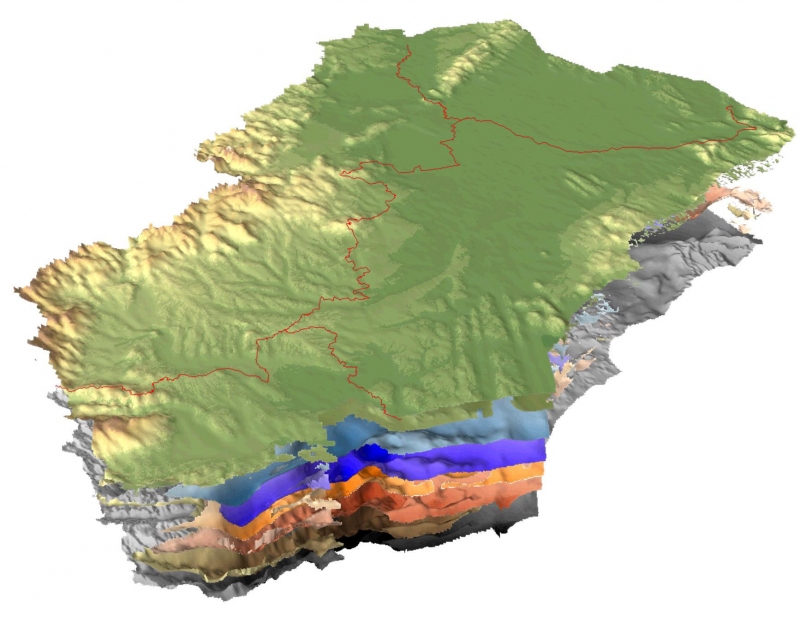
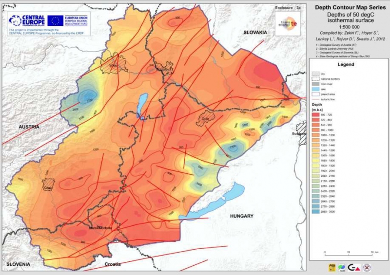
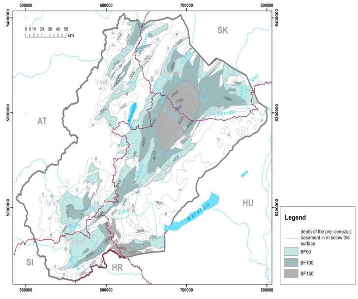
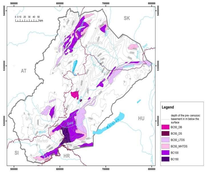
Contour maps of isotherm
surfaces:
-50 °C
-100 °C
-150 °C
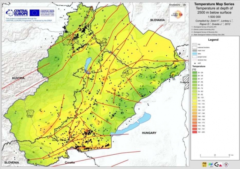
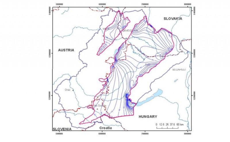
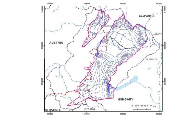
Temperature map in different
depths:
-100 m
-2500 m
-5000 m
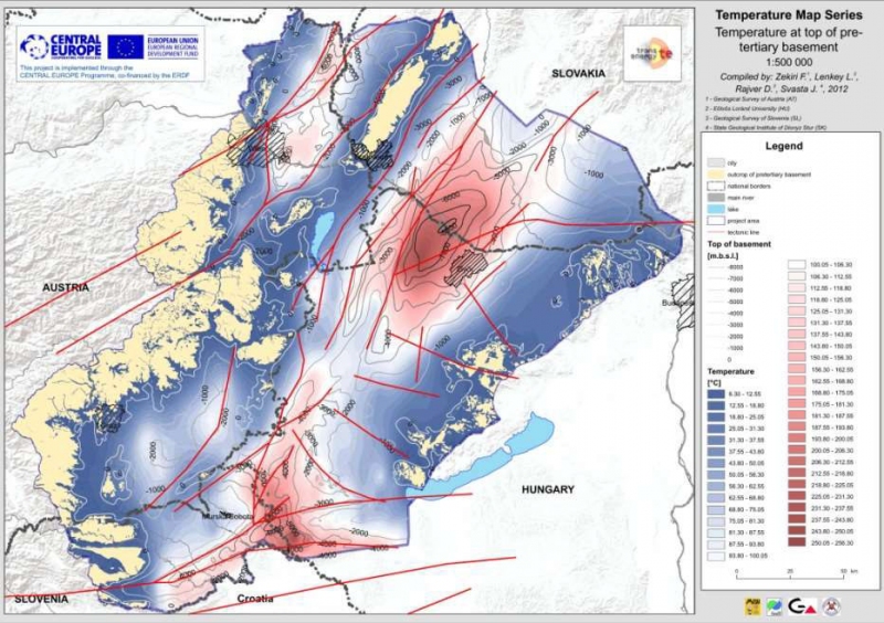
Temperature at the top of the basement
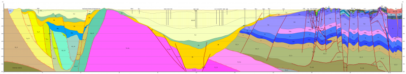
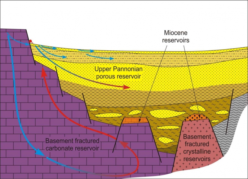
Main reservoir categories:
Sub-categories:
Type of aquifer :
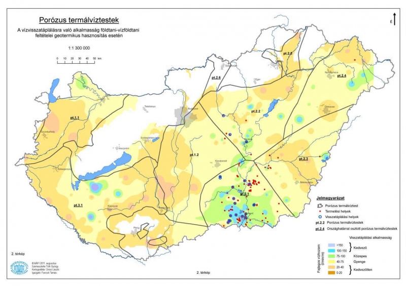
– porous reservoirs
– reservoirs with double porosity
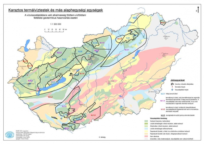
– fractured or karstified carbonate reservoirs
– fractured crystalline reservoir
Temperature:
– 50-100 ° C
– 100-150 ° C
– above 150 ° C
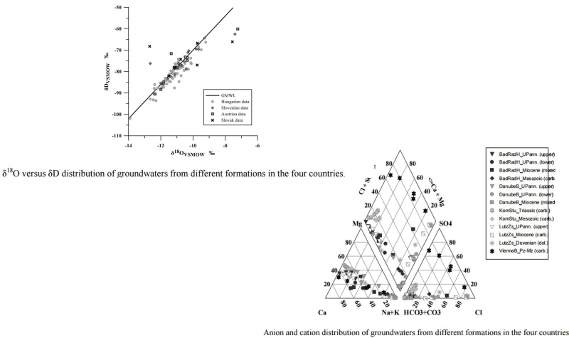
Hydrogeochemical composition
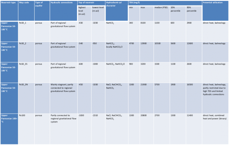
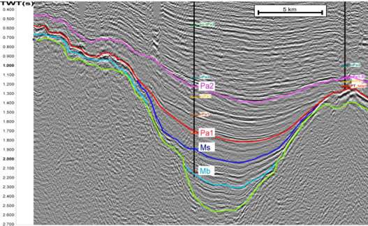
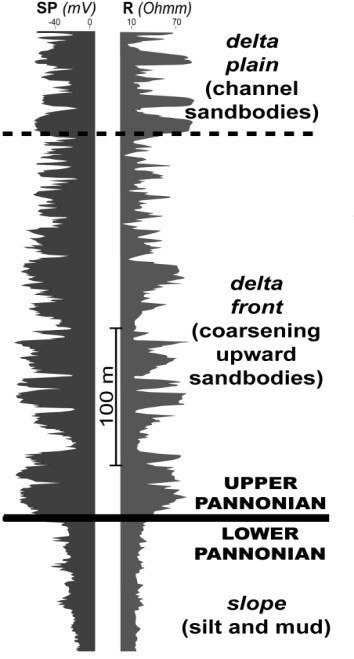
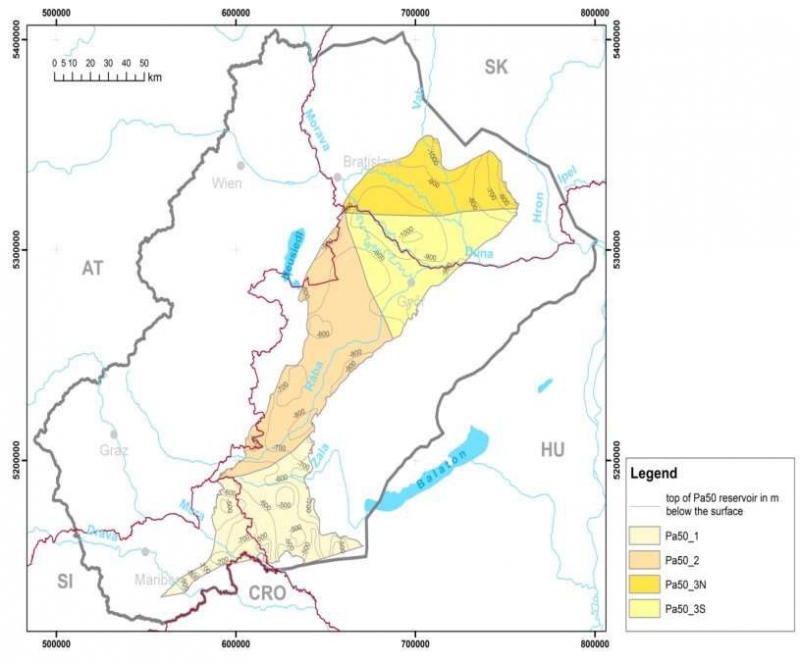
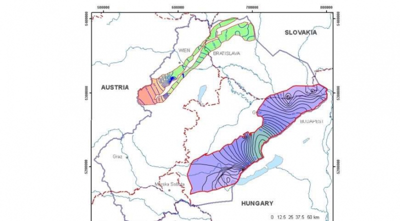
Potential Upper Pannonian reservoirs
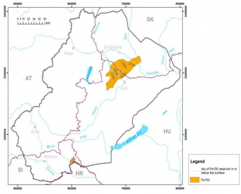
Potential Miocene reservoirs
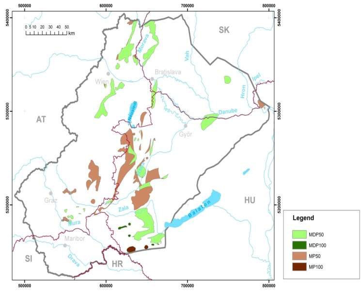
Potential basement fractured crystalline reservoirs
Potential fractured carbonate basement reservoirs
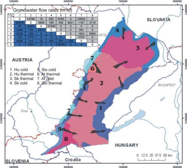
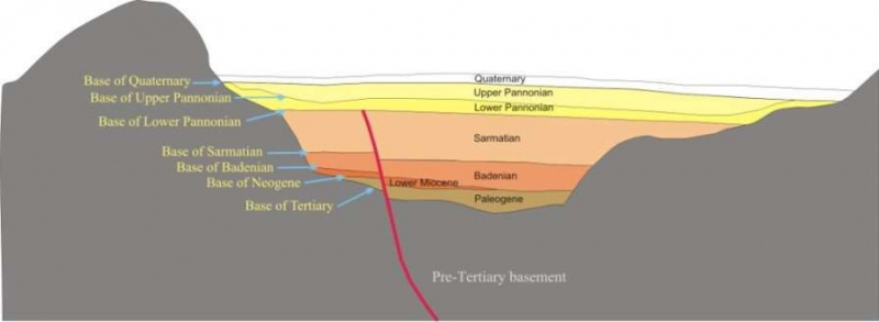
Calculated cold groundwater heads
Calculated thermal water heads of the Upper Pannonian (below 450 m)
Calculated karstwater heads in the thermal karst systems
Computed budgets of the major delineated groundwater bodies, including trans-boundary water transfers