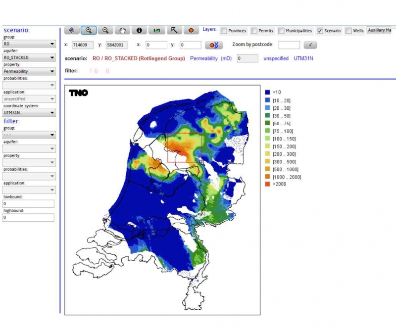
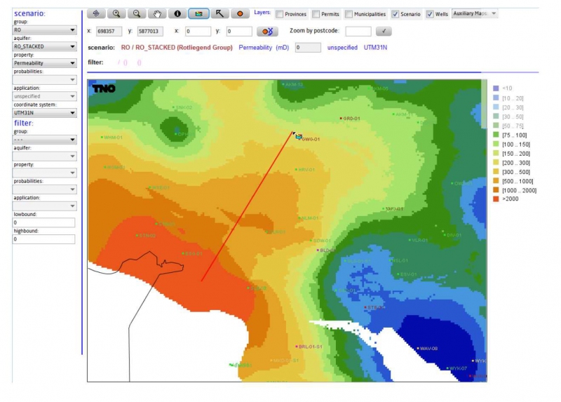
Summary/aim: A public web-based information system ThermoGIS provides depth, thickness, porosity and permeability maps of many potential aquifers in the Netherlands. In addition, a stochastic fast model based performance module is integrated in ThermoGIS that enables the user to automatically assess the generated power, expected flow rate, the Coefficient Of Performance (COP) and economic variables for any specific location.
Involved countries: NL
Features: Web viewer, Techno-economic performance resource assesment, doublet calculator, one could generate cross-sections or syntetic borehole profiles
Pros: Developed methodology for geothermal potential assesment
Cons: Very detailed data is needed
Link: http://www.thermogis.nl/thermogis_en.html
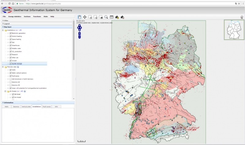
Summary/aim: The Geothermal Information System shows the geothermal potentials and installations of deep geothermal use in Germany.
Involved countries: DE
Features:Map viewer (geothermal instalations, wells, cross-sections, fault-zones, locations of 2D and 3D seizmic survey, hydrothermal potential areas, formation hydraulic conductivity, concession areas, geothermal potential maps, locations of 3D models of reservoirs
Pros: A lot of very useful information, very transparent
Cons: Availability and public access to data
Link: https://www.geotis.de/
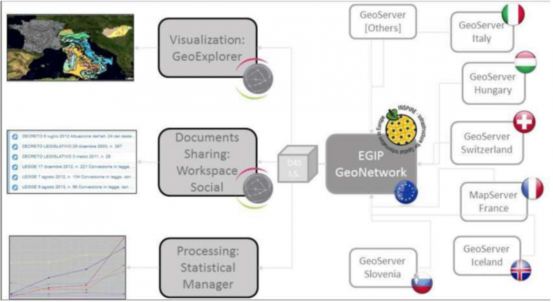
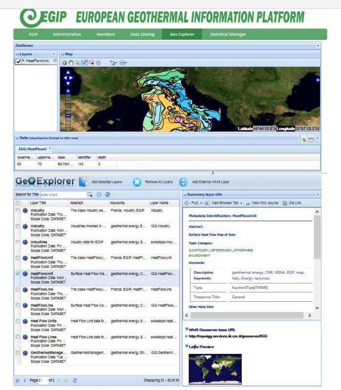
Summary/aim: The core function of the EGIP is to organize geothermal data and information at a European scale. The EGIP pilot is aimed to demonstrate the platform capabilities and usefulness to the main geothermal actors in Europe (i.e., scientists, politics and industrial).
Involved countries: IT, FR, CH, HU, SI
Features: document sharing point, social network, geoexplorer, statistical manager
Pros: metadata are INSPIRE arranged, distributed database system
Cons: metadata are INSPIRE arranged, user unfriendly
Link: http://www.geothermaleranet.is/joint-activities/egip/
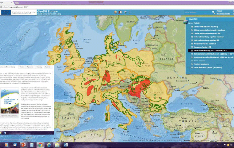
Summary/aim:On this website you can find out more about Geothermal District Heating in Europe: how it works, the European market and its future development, regulation, financing, and Potential.
Involved countries: HU, SI, BG, IT, FR, PL, NL, DK, SK, EGEC
Features: Map viewer (HFD, temperature at depth, reservoir outlines, cities with district heating, including geothermal), Case studies, Guidelines Reports on Financing and Regulation
Pros: for routing policy
Cons: Small scale, not enough detailed for feasibility studies
Link: http://geodh.eu/
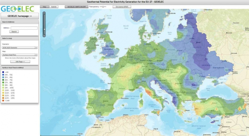
Summary/aim: Based on currently available information, the GEOELEC Geographical Information System presents for the first time ever a geothermal resource assessment from 1km to 5km depth of Europe.
Involved countries: EGEC
Features: Map viewer (average surface temperature, model temperature at different depth to 10 km, Surface heat flow, depth of MOHO, depth of sediment&basement boundary, heat in place, geothermal potential)
Pros: Guidelines Methodology for estimation of teotetical and technical potential for geothermal electricity
Cons:
Very general information
Link: http://www.geoelec.eu/test-geoelec-online-viewer/
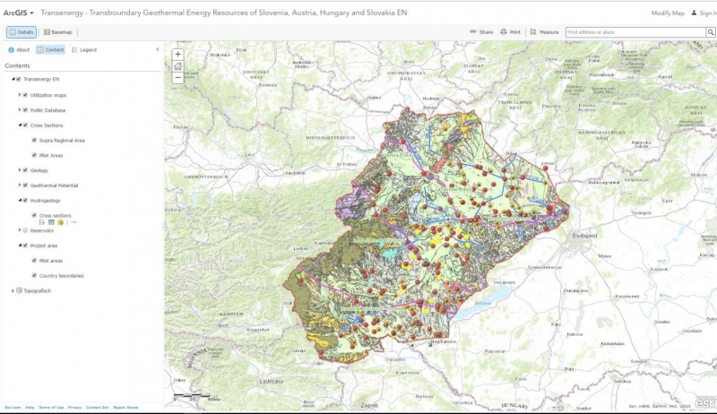
Summary/aim: to create a common geothermal information system in four central European countries. Having an environmental focus the purpose is seeking for sustainable, transboundary utilization of geothermal energy resources.
Involved countries: HU, SI, AT, SK
Features: Web Map Service (model of surfaces, cross-section, utilisation maps, temperature and HFD maps, outlines of Reservoir, database of boreholes)
Pros: a lot of information for very broad spectre of stakeholders
Cons: fragmentation of databases (not all info available in one viewer), visibility of some isolines not good enough
Link: http://transenergy-eu.geologie.ac.at/
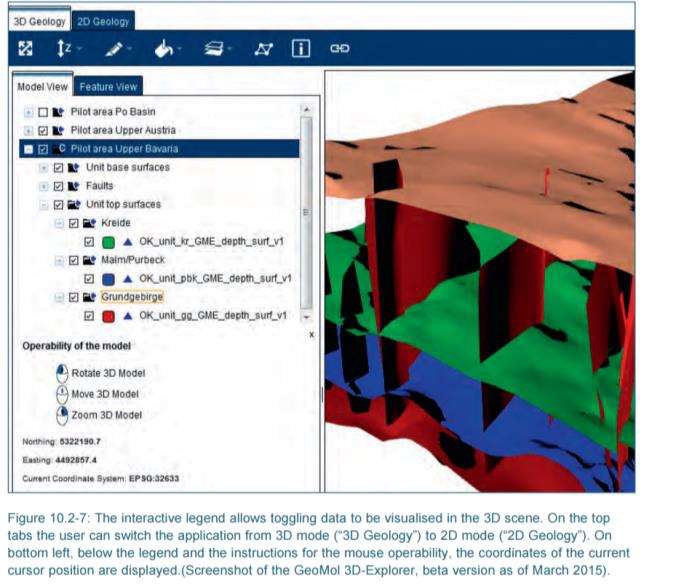
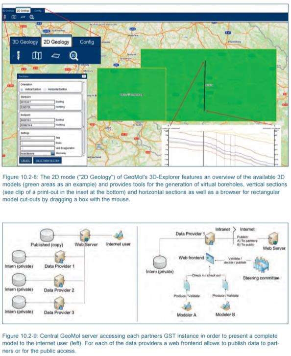
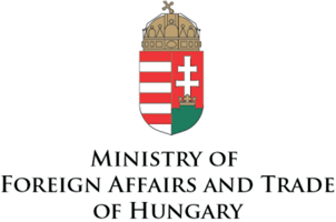
Summary/aim: Assessing subsurface potentials of the Alpine Foreland Basins for sustainable planning and use of natural resources. GeoMol provides consistent 3-dimensional subsurface information based on coherent evaluation methods and commonly developed criteria and guidelines. Enhancing the common knowledge of the subsurface in the Alpine Foreland Basins will help to boost homemade, decentralized green energy by exploiting geo-potentials and using subsurface storage capacities.
Involved countries: DE, FR, AT, CH, IT, SI
Features: Map viewer, 3D-explorer
Pros: very good presentation of 3-D models models avaiable on web for end user, one could generate cross-sections or syntetic borehole profiles
Cons: expensive nonstandard commercial software, not user friendly
Link: http://www.geomol.eu/home/index_html