Experience from geothermal and hydrocarbon concessional works in Hungary
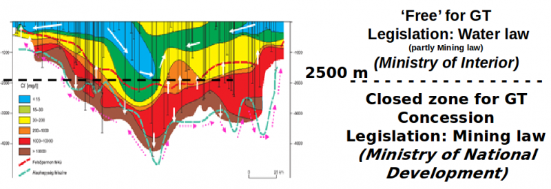
Closed areas and the mining concession
- From 2011 (the first bid in 2013): the Minister of National Development (responsible for mining affairs) may lease tender on a closed area for
-the exploration, development and exploitation of mineral resources
-the exploration, recovery and utilization of geothermal energy
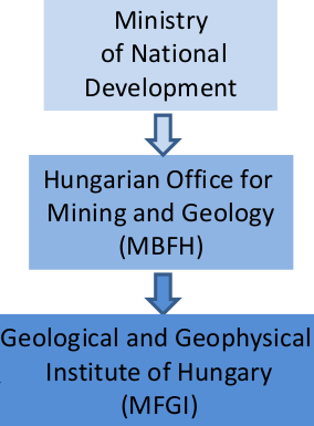
- The concession tenders are prepared by Hungarian Office for Mining and Geology (MBFH) supported by MFGI.
Legislation on geothermal energy in Hungary
The concession procedure
1. Selection of potential concession plots (areas)
-Investor’s initiatives for proposed plots for tender (Areas requested by developers).
-Plots (areas) selected by MBFH, MFGI.
2. Complex vulnerability and impact assessments (reports)
-Are available, can be downloaded from the official website of the Hungarian Office for Mining and Geology MBFH). http://www.mbfh.hu/home/html/index.asp?msid=1&sid=0&hkl=538&lng=1
3. The Concession Call for Tender / Tender Announcement
-Based on the assessments, the minister announce the concession tender for those areas being favorable for exploiting mineral resources or recovering geothermal energy for energetic purposes.
-Data packets are compiled for all tendered plots that are available for all tender candidates in the Hungarian State Geological, Geophysical and Mining Databank operated by the MBFH.
-Exploration data is in public domain after 3 years.
4. The Concession contract
-Prospect for, extract and utilize HC (the duration of the concession is 20 years for hydrocarbon, which can be prolonged once with 10 years).
-Prospect for, extract and utilize GtE (the duration of the concession is 35 years for hydrocarbon, which can be prolonged once with 12,5 years).
-The applicant’s exploration right regarding Hungary is restricted in case of hydrocarbons (15,000 sq km) in order to secure competitive framework.
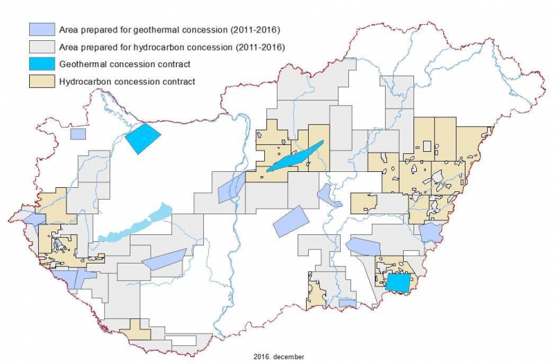
Up to 2017 3 concessions for geothermal energy (below 2500 m),
and 21 for hydrocarbon
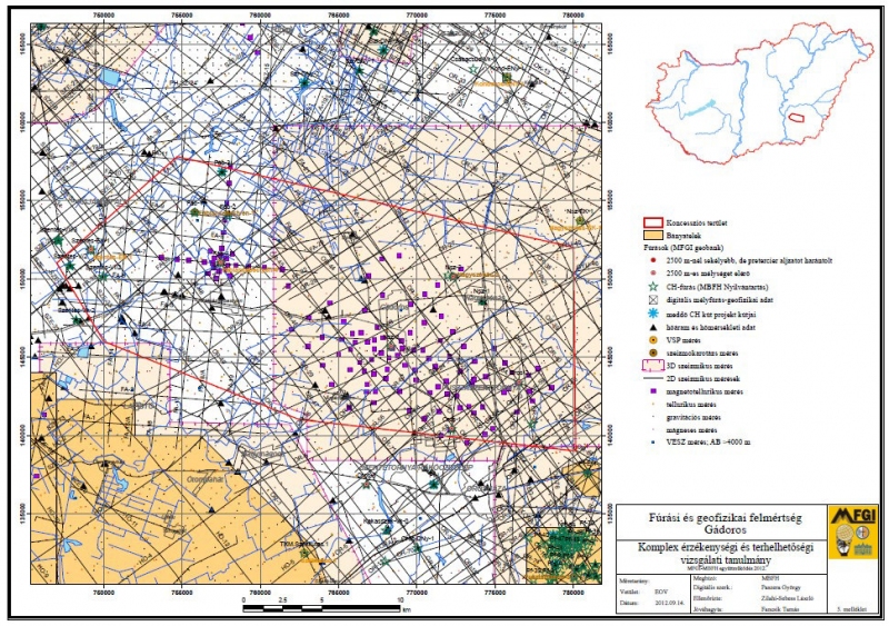
54 potential concession areas were analyzed – 54 Complex vulnerability and impact assessment studies were completed
34 hydrocarbon, 17 geothermal, 2 coal, 1 ore.
Content of the Complex vulnerability and impact assessments study. Chapter 1
1. Description of the proposed concession area
- 1.1. Geographical description
- 1.1.1. Geographic and spatial location
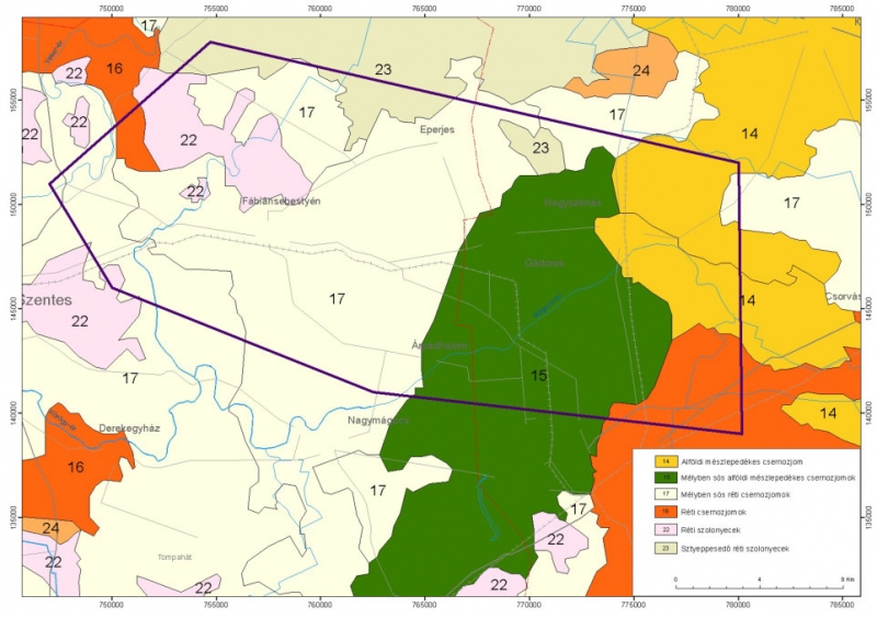
- 1.1.2. Soil and natural vegetation
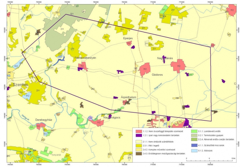
- 1.1.3. Land cover (land use) (Corine LC)
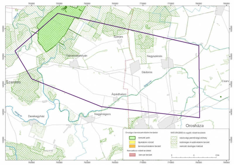
- 1.1.4. Conservation (Nature protection)
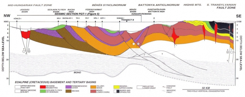
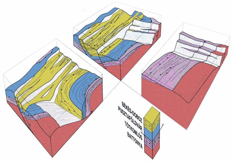
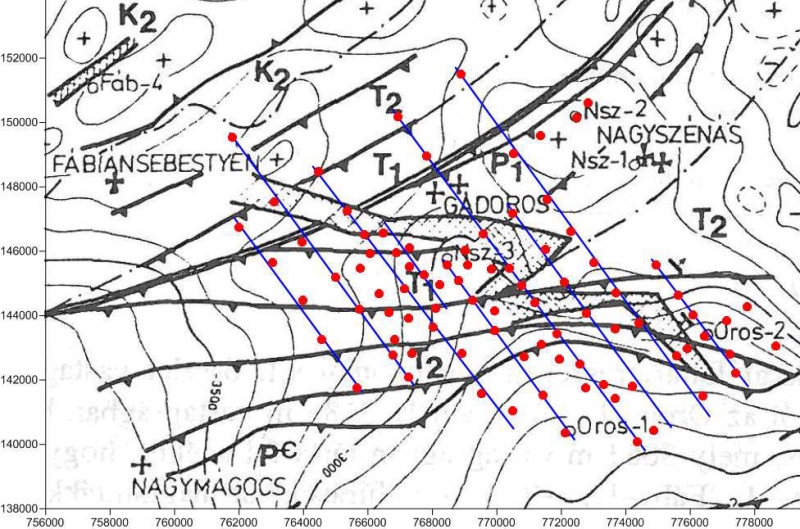
- 1.2. Geological, tectonic characterization, exploration level (geological and geophysical)
- 1.2.1. The geological and geophysical exploration level – available data in the Data store of MBFH, MFGI
- 1.2.2. Tectonic characterization, large structures, structural developments, seismicity
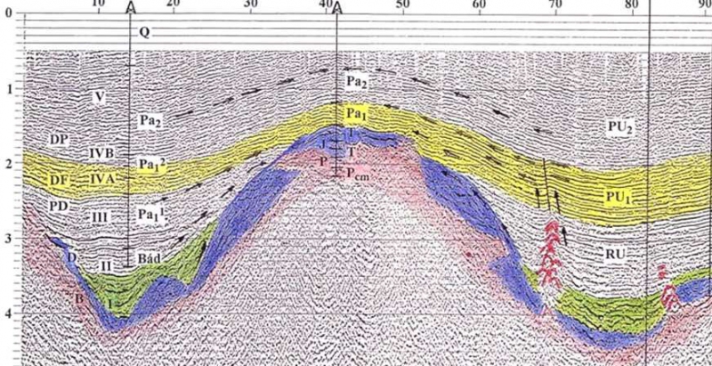
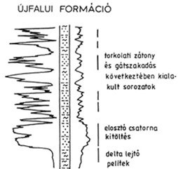
- 1.2.3. Formations of the Pre-Cenozoic basement
- 1.2.4. Cenozoic formations
- 1.3. Hydrogeology
- 1.3.1. Hydrogeological conditions of porous formations in the basin
- 1.3.2. Reservoirs of the basement
- 1.3.3. Natural recharge of the hydrogeological units
- 1.3.4. Natural drainage of the hydrogeological units
- 1.3.5. Groundwater quality
- 1.3.6. Hydrodynamic systems, pressure condition
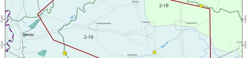
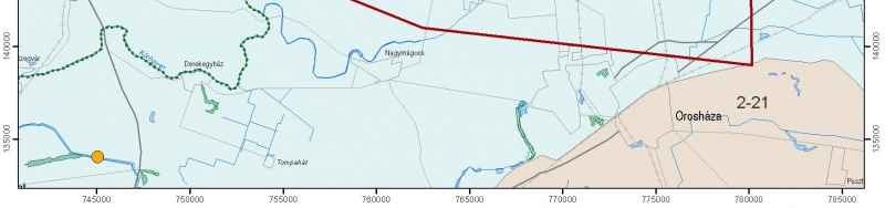
- 1.4. River basin management
- 1.4.1. Surface waters, and surface and subsurface waterbodies
- 1.4.2. Pressures and impacts on surface and subsurface waters
- 1.4.3. Transboundary water bodies
- 1.4.4. Monitoring System
- 1.4.5. Quantitative and qualitative status evaluation
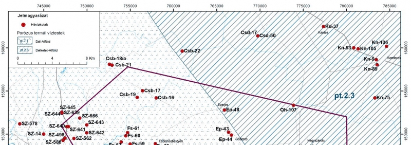
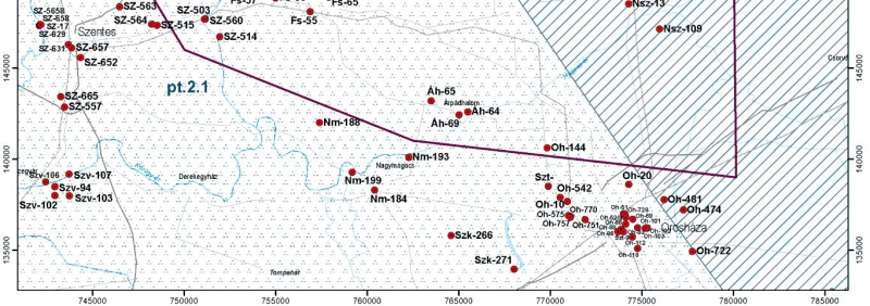
- 1.5. Geothermal utilization of thermal waters, valid exploration and mining licences of raw materials and known mineral resources
- 1.5.1. Geothermal utilization of the thermal waters in the area
- 1.5.2. Valid prospecting and mining rights of raw materials in the concession area
- 1.6. Legislative prohibitions and restrictions on mining activity effecting the concession area and space
Geography and geology
Location map
Protected areas National parks, Natura 2000 …
CORINE landcover
Soil types
Former geological, HC reports
Available boreholes, surface
geophysics, and well-loggings
Geology
Structure, tectonics
Seismics
Magnetotellurics
Well-logging
Hydrogeology
Surface water bodies
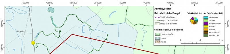
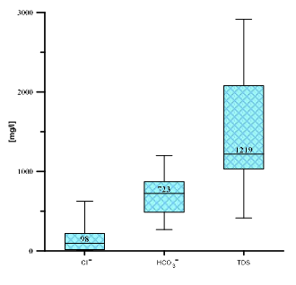
Water chemistry
Shallow groundwater bodies, shallow wells
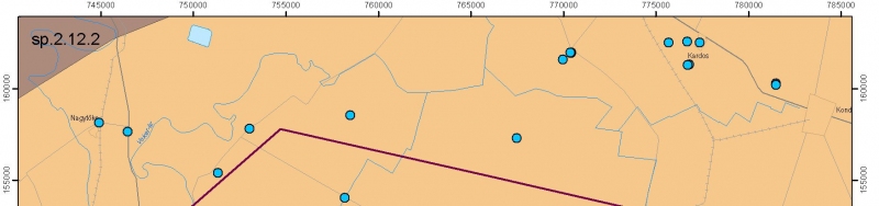
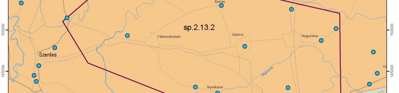
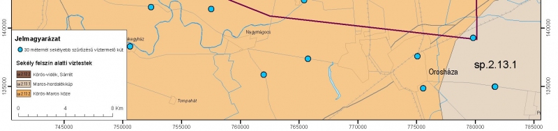
Thermal water bodies with thermal wells
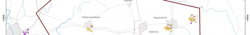
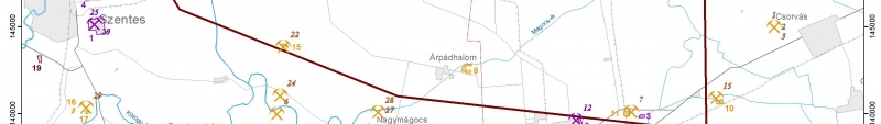
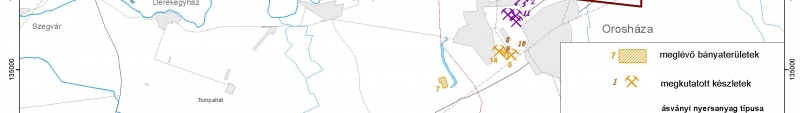
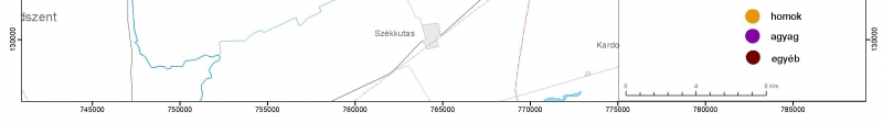
Commodities, mineral resources
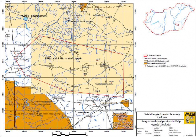
Hydrocarbon
Geothermal (under mining law)
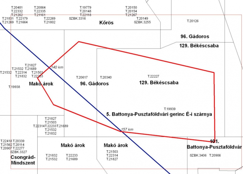
Exploration licence areas
Mining licence areas
Metallic and Nonmetallic
mineral resources
Content of Comlex vulnerability and impact assessments study. Chapter 2
2. Study of the proposed mining concession activities
- 2.1. Data on geological characteristics, productivity and expected volume of raw material or geothermal energy subject of concessions
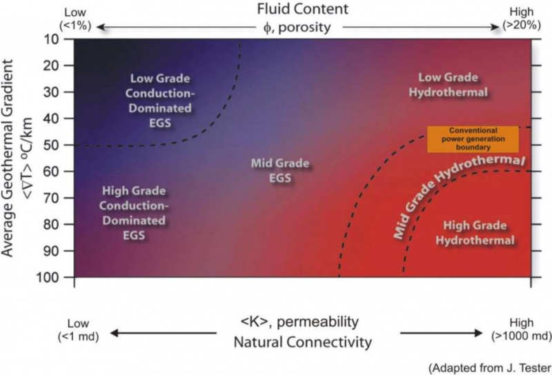
- 2.1.1. Geothermal conditions of the area
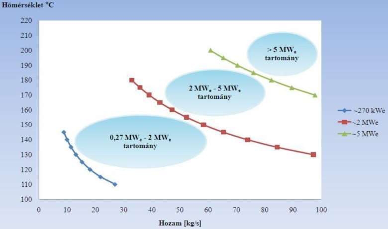
- 2.1.2. Expected volume of geothermal energy
- 2.2. Presentation of the expected exploration and production methods and known mining technologies implemented during mining operations
- 2.2.1. Presentation of the expected research and exploration methods (technologies)
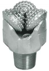
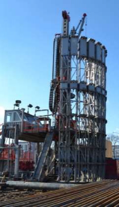
- 2.2.2. Presentation of the expected production methods (technologies)
- 2.2.3. Presentation of the expected known mining technologies implemented during mining operations
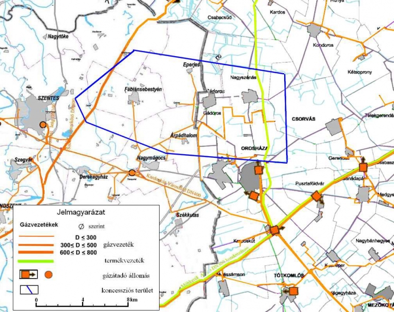
- 2.3. General description - Possible related activities - transport, storage, waste management, energy supply, water supply
- 2.4. Infrastructure
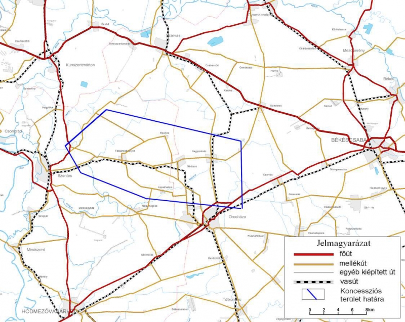
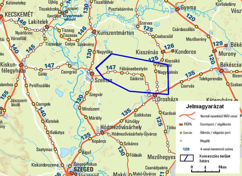
- 2.4.1. Road and railway network
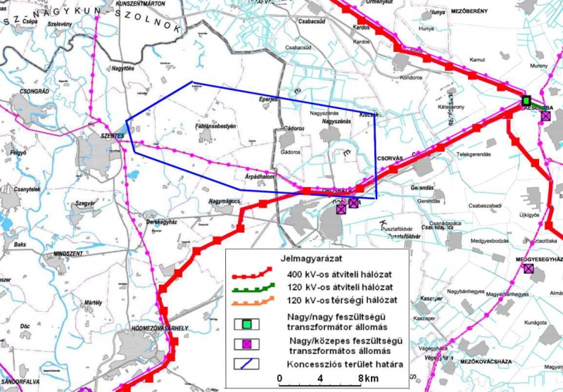
- 2.4.2. Energy Network
- 2.5. Presentation of mineral resource management and energy supply objectives implemented in the course of mining operations
- 2.6. Presentation of the mining activities in mineral resource management perspective, as well as the expected national economic and social benefits
- 2.7. Expected duration of the load
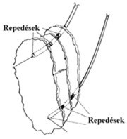
- 2.8. The most important expected mining risks
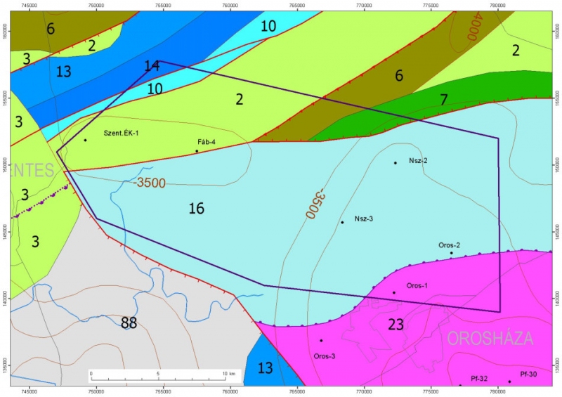
Geothermal conditions
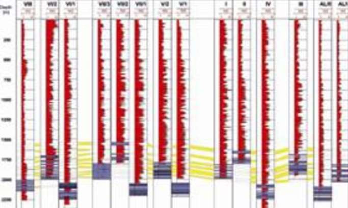
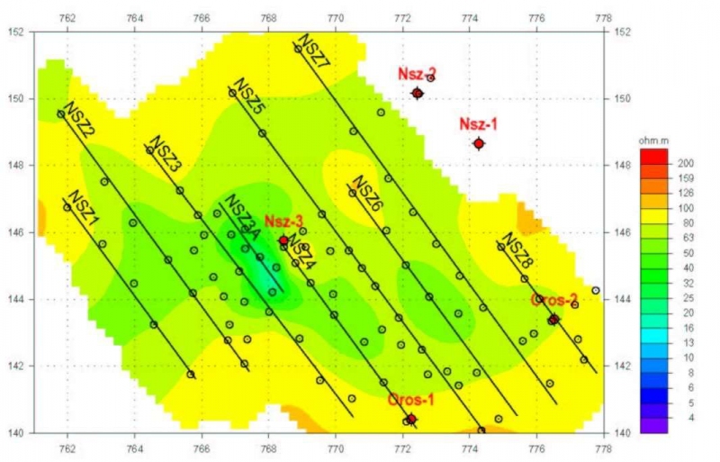
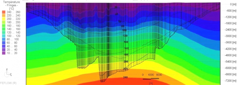
Temperature–depth functions T(z), sections, maps
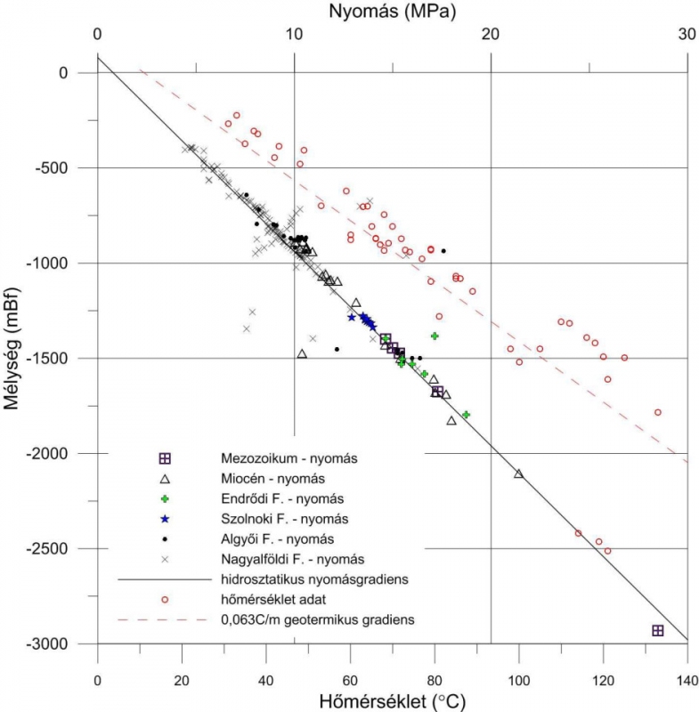
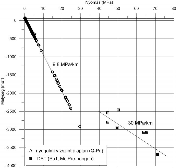
Pressure–depth functions P(z), sections, maps
Heat-flux heat capacity from boreholes, samples
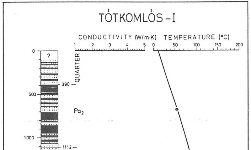
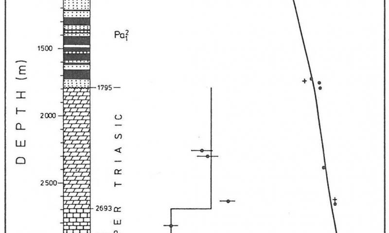
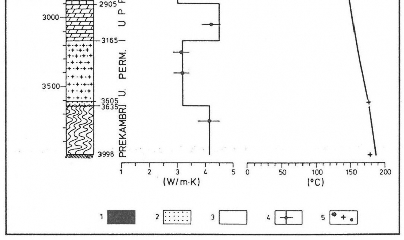
Temperature – depth function from the boreholes of the area
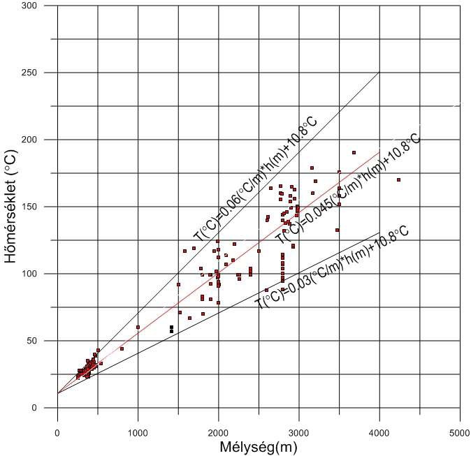
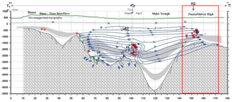
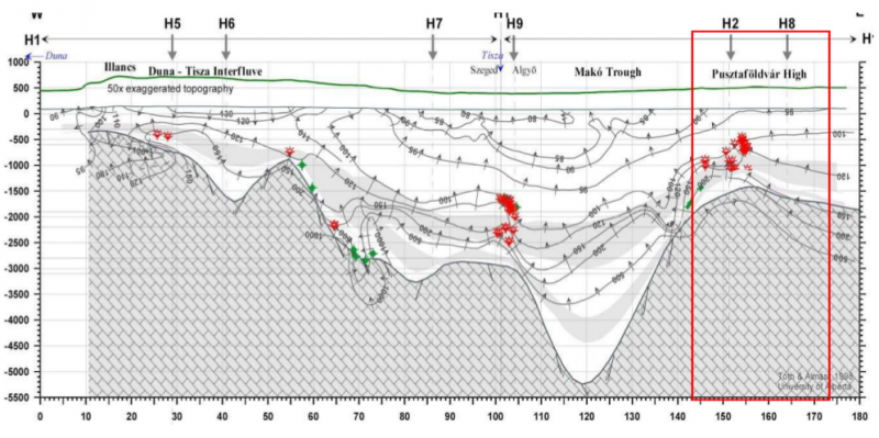
Temperature – depth section
Research, exploration, production methods
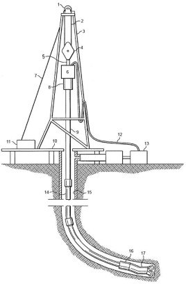
Infrastructure
Transport and transfer:
Roads, railways, pipelines, electric lines
Content of the Vulnerability and loading capability assessments study. 3. chapter
3. Effects, consequences and forecast analysis
- 3.1. Outline of those elements of the area and space, that may significantly be influenced by the planned activity
- 3.1.1. Porosity conditions of the penetrated layers
- 3.1.2. Pollution-sensitivity of the penetrated layers
- 3.1.3. Impact bearing surface environmental elements
- 3.1.4. Environmental stresses caused by mining activity
- 3.1.5. Air Quality Protection
- 3.1.6. Noise and vibrations
- 3.1.7. Impacts on groundwater
- 3.1.8. Impacts on surface water
- 3.1.9. Conservation (Nature protection)
- 3.1.10. Landscape Conservation
- 3.1.11. Land and soil protection
- 3.1.12. Forestry and wildlife protection
- 3.1.13. Health protection
- 3.1.14. The built environment and cultural heritage
- 3.2. Evaluation of the impacts of mining operations on surface and groundwater bodies, drinking water, and protected Natura 2000 sites, listing the expected changes and their regional and transboundary effects
- 3.2.1. Impacts in the geothermal reservoirs
- 3.2.2. Interaction between the geothermal reservoirs and surface
- 3.2.3. Impacts on the surface
- 3.2.4. Transboundary impacts
- 3.2.5. Summary evaluation of the various impact
- 3.3. List of restricted or prohibited mining technologies on the area due to its environmental impacts